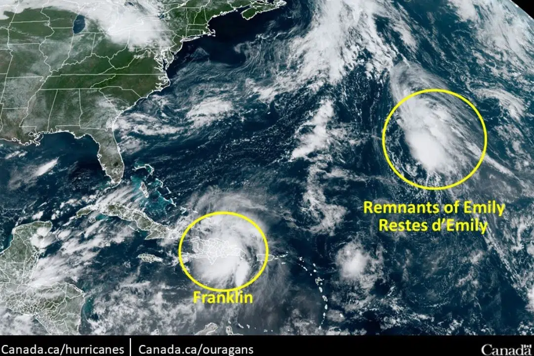
What impact if any Tropical Storm Franklin will have for Nova Scotia and Atlantic Canada won’t be known until later this weekend.
Currently, Franklin is moving west out towards the Atlantic, by Saturday night it’s expected to change directions again heading west towards the Carolinas.
On that voyage it’s expected to gain power, likely being upgraded to a Category Three Hurricane by the time it turns westward.
Passing the Carolinas will be when the storm’s final trajectory is determined, with a more firm idea of Franklin’s track expected by late Sunday night.
The Weather Network meteorologist Doug Gillham says the most critical variable in determining what way it goes comes down to jetstreams, “At that point it all comes to the timing and depth of the dip in the jetstream that’s coming through the Appalachians,”.
Gillham believes the most likely outcome is it will be sent back out towards the Atlantic, where it will eventually die out.
“It’s still too early to let our guard down in Atlantic Canada as even if it ends up missing us, it will be close enough that it will be bringing heavy rain and stronger than usual winds to the region,” Gillham said.
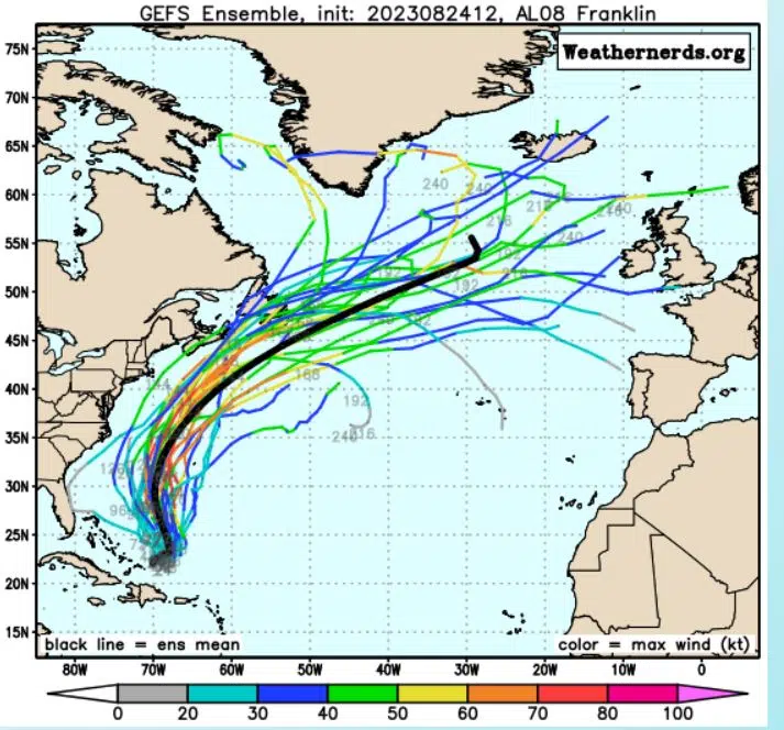
Current modeling takes into account all of the possible trajectories for Franklin, and in the image below the black line represents the mean track of all the possibilities.

A map showing the possible tracks for Tropical Storm Franklin. Photo: Weather Nerds.
Although the above image doesn’t show it Gillham says Franklin also has a chance, albeit slim to head more directly into New England.


